

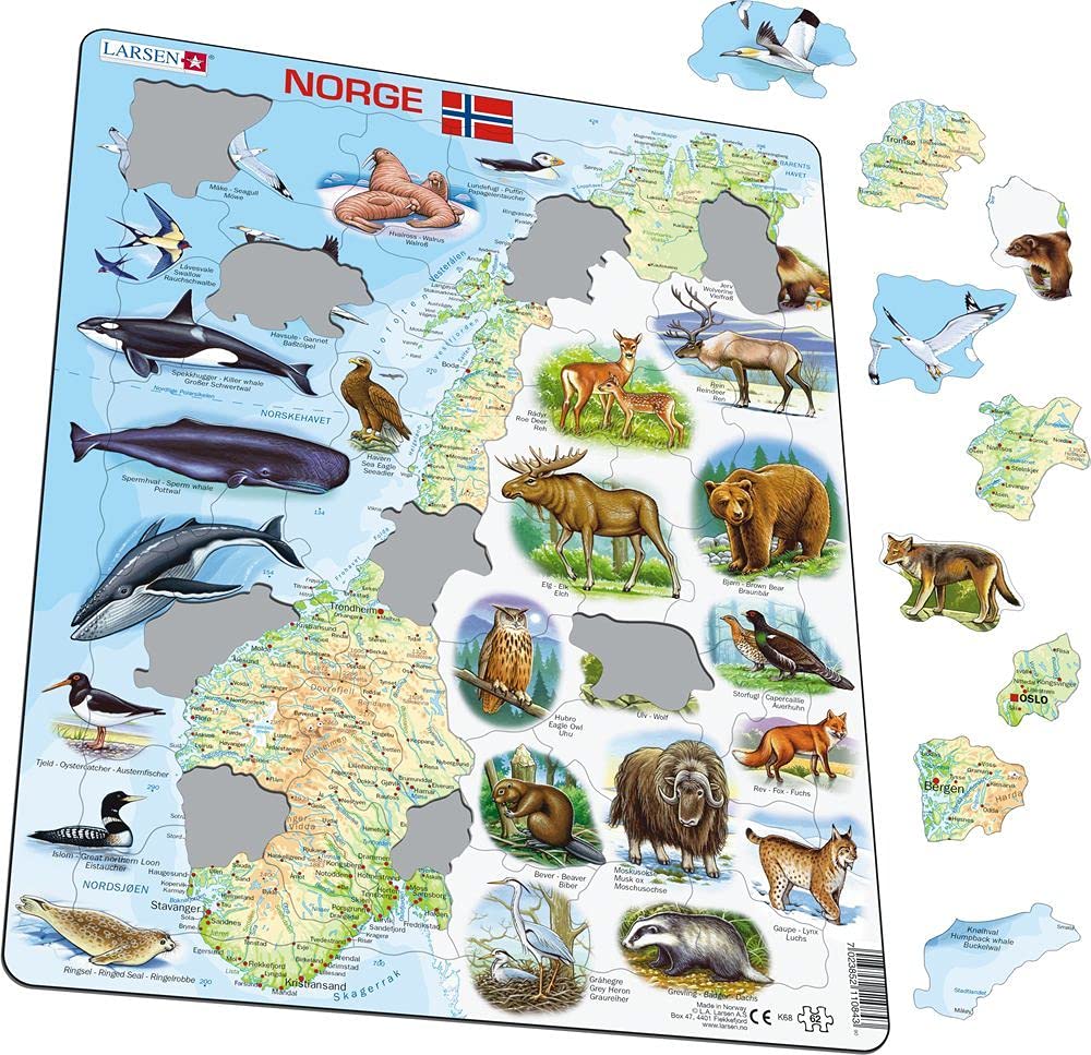

This physical map of Norway has names of cities, rivers, lakes, fjords, mountain ranges, glaciers, and islands. The highest mountaintops are marked with names and altitude in meters. Many of the puzzle pieces are cut along the country- and county borders and coastlines. Around the map are pictures of animals that live in Norway and outside the coast of Norway.
Trustpilot
1 day ago
5 days ago